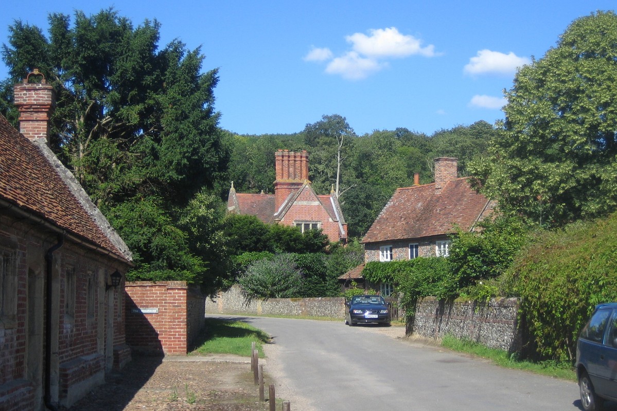
SOUTH OXFORDSHIRE VILLAGES ON THE RIVER THAMES
There are many attractive villages on or very near the River Thames and those on the river often have riverside amenities. If they are a little way from the river it is usually only a short stroll by footpath to the river bank and this usually gives the opportunity for a pleasant riverside walk. Then what better than to enjoy a pleasant lunch or drink in one of the village pubs or tea rooms?
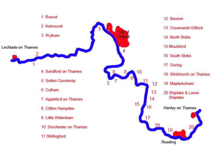
The following Thames-side villages are in South Oxfordshire and brief information about them is given below:
Sandford on Thames (No. 4 on the map)
Culham (No. 6 on the map)
Clifton Hampden (No. 8 on the map)
Little Wittenham (No. 9 on the map)
Dorchester on Thames (No. 10 on the map)
Shillingford (No. 11 on the map)
Benson (No. 12 on the map)
Crowmarsh Gifford (No. 13 on the map)
North Stoke (No. 14 on the map)
Moulsford (No. 15 on the map)
South Stoke (No. 16 on the map)
Goring (No. 17 on the map)
Whitchurch on Thames (No. 18 on the map)
Mapledurham (No. 19 on the map)
Shiplake and Lower Shiplake (No. 20 on the map)
All the other villages (except Kelmscott) are in the Vale of White Horse and they are described here. Kelmscott is in West Oxfordshire, and information and pictures of Kelmscott can be found here.
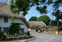
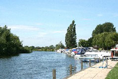
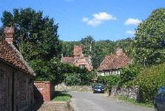
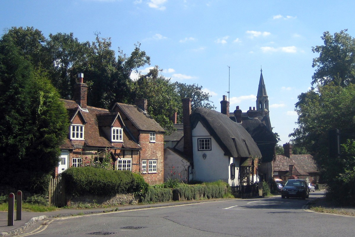
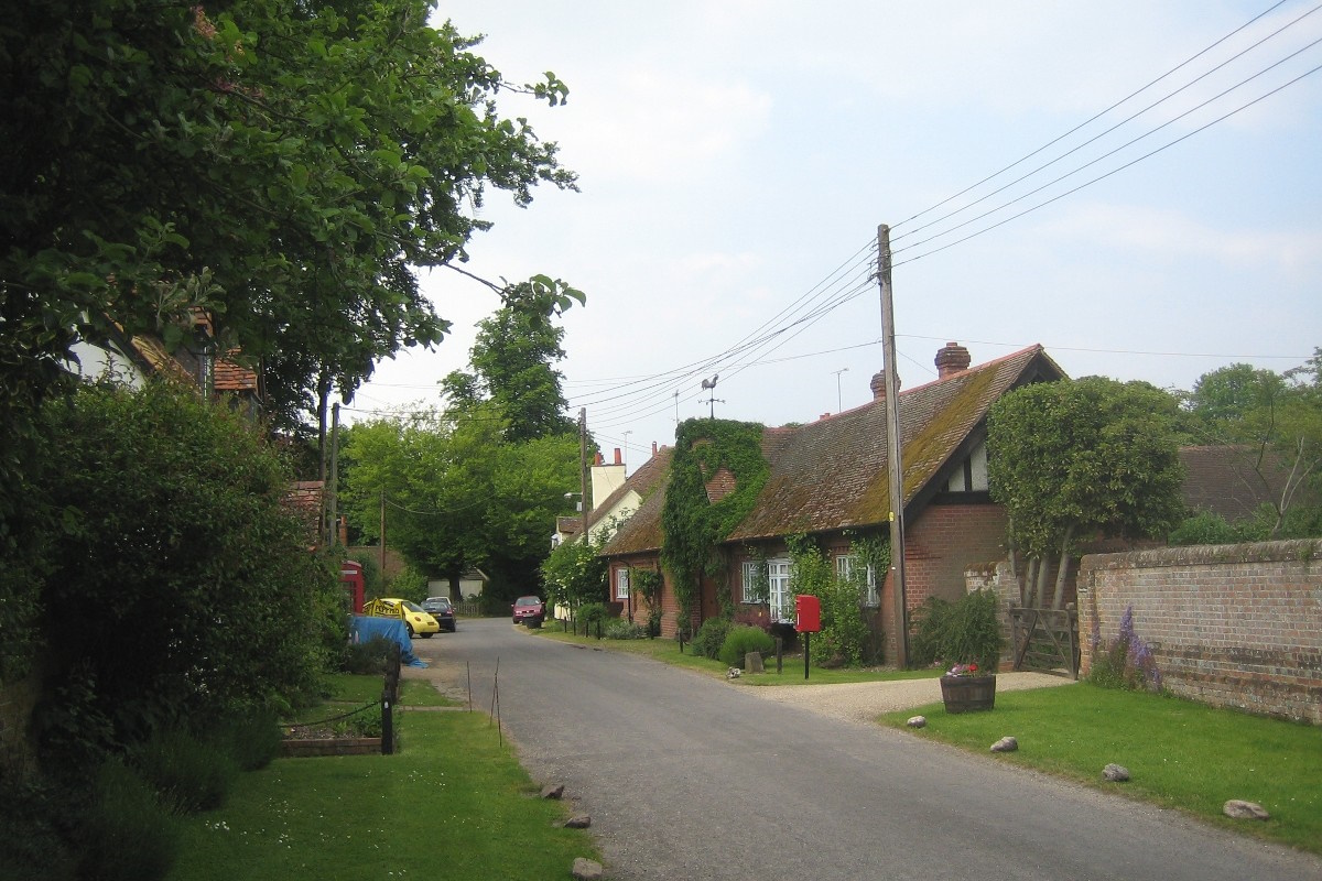
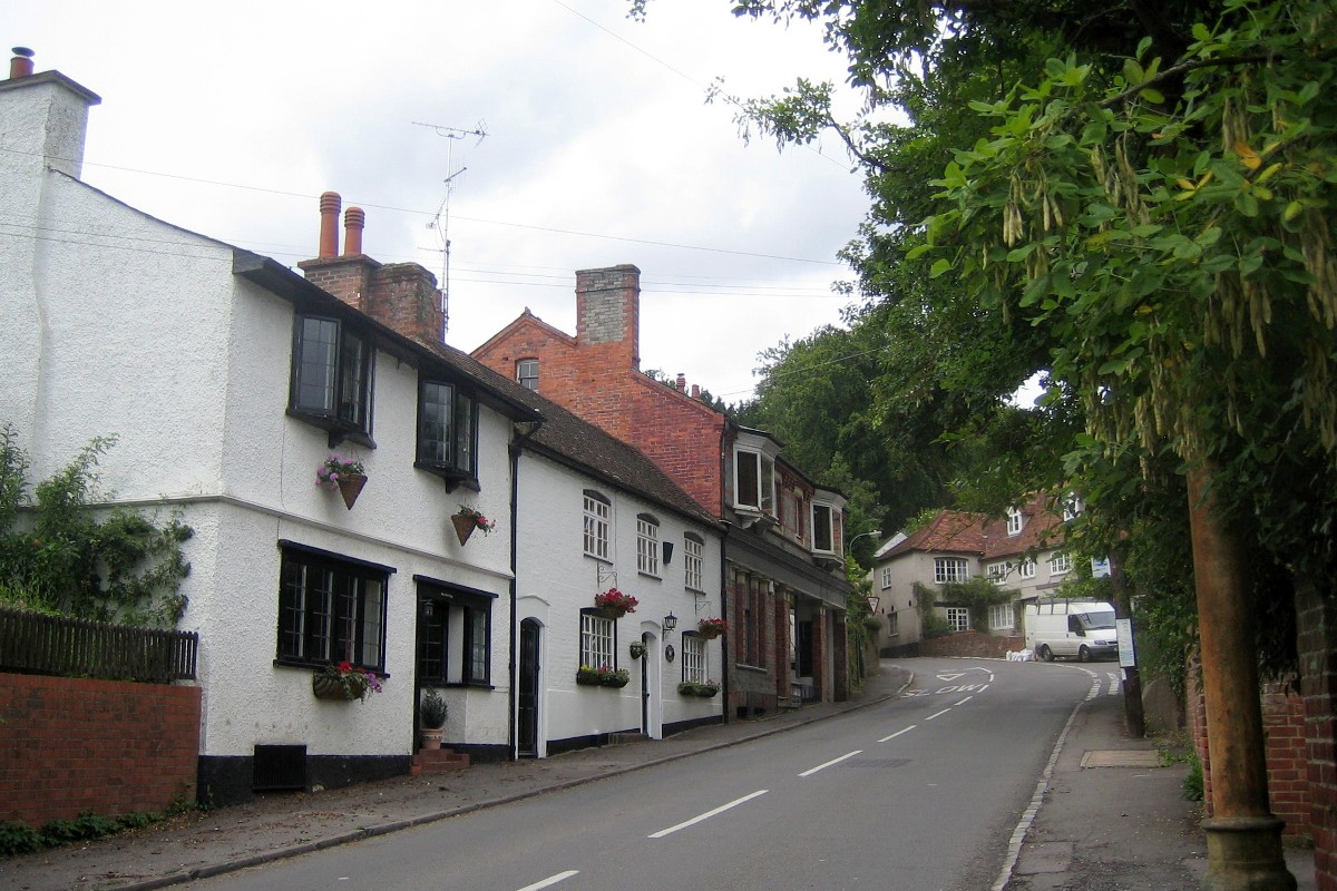
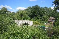
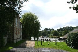
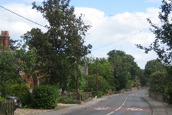
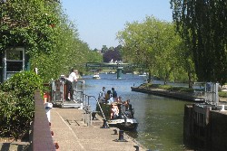
4 Sandford on Thames
.jpg) Access to the River Thames from the village centre is by way of St. Andrew's Road, and Sandford Lock can be reached across a footbridge adjacent to the popular Kings Arms public house. Next to the pub's car park is a small green which used to be a wharf, and on the other side of the pub and next to the lock a housing development stands on the site of the former Sandford Mill. This was originally a corn mill belonging to the Abbey of Abingdon and recorded in 1100 as owned by the local monks for bread making. It was converted to a paper mill in 1826 and finally closed in 1982. Access to the River Thames from the village centre is by way of St. Andrew's Road, and Sandford Lock can be reached across a footbridge adjacent to the popular Kings Arms public house. Next to the pub's car park is a small green which used to be a wharf, and on the other side of the pub and next to the lock a housing development stands on the site of the former Sandford Mill. This was originally a corn mill belonging to the Abbey of Abingdon and recorded in 1100 as owned by the local monks for bread making. It was converted to a paper mill in 1826 and finally closed in 1982.
There are a couple of pubs in the village, one of which is right beside the river opposite Sandford Lock.
Sandford-on-Thames is just off the A4074 Oxford to Henley road about a mile south of the southern Oxford ring road.
Find Sandford on the Ordnance Survey map |
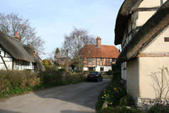
6 Culham
 The oldest part is clearly centred on the
Green at the western end. Just off the Green is the church,
St. Paul's, and the Manor House. St.Paul's Church is a
Victorian church built on the site of a former mediaeval
church. North of the Green, behind a high
brick wall, is Culham House, the largest house in the
village. Culham House was built about 1775 by John Phillips,
lay rector of the parish. The oldest part is clearly centred on the
Green at the western end. Just off the Green is the church,
St. Paul's, and the Manor House. St.Paul's Church is a
Victorian church built on the site of a former mediaeval
church. North of the Green, behind a high
brick wall, is Culham House, the largest house in the
village. Culham House was built about 1775 by John Phillips,
lay rector of the parish.
A footpath from the Green leads southwards to the River Thames, some 250 yards away. Culham Lock is on the edge of the village and can be reached from the road to Sutton Courtenay and Appleford on Thames.
The village was at one time important for the Thames barges
carrying stone from the dissolved Abbey of Abingdon and
there was wharfage at Culham. The wharf and the
remains of the lock can still be seen as well as the assembly
pool for barges that lay near it. These were in the ditch
now known as Back Water, but then known as Swift Ditch.
Swift Ditch was at the time the main navigation channel
when it was abandoned in 1790 in favour of the main
channel through Abingdon.
Where the road from the village meets the main road the
old Culham Bridge still stands spanning the now insignificant
Back Water. The old bridge is built across the site of
the ancient ford known as Culham Hyth. Old Culham Bridge can also be reached by following the Thames Path round from Culham Lock.
Culham is about a mile and a half south of Abingdon just off the main Abingdon to Dorchester road, the A415.
Find Culham on the Ordnance Survey map |
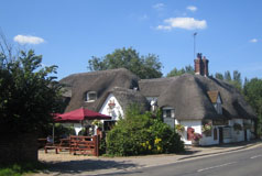
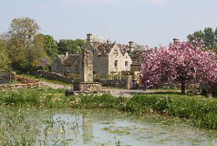
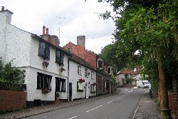
8 Clifton Hampden
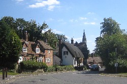 Clifton
Hampden is an attractive picture-postcard Thames-side village.
Overlooking the river is the Church
of St. Michael & All Angels perched on top of a small hill. Clifton
Hampden is an attractive picture-postcard Thames-side village.
Overlooking the river is the Church
of St. Michael & All Angels perched on top of a small hill.
The village is bypassed by the A415 so is is largely quiet and unspoiled, although between the bridge and the traffic lights on the main road it can be busy. Clifton Hampden bridge is very attractive and worth crossing as the well-known Barley Mow pub is on the other side.
The village and The Barley Mow were featured in Jerome
K. Jerome's book Three Men in a Boat, and in 1885 Dickens's Dictionary of the Thames said of Clifton
Hampden, 'Clifton Hampden, this picturesque little
village, is situated at the foot of a bold bluff, which
rises abruptly from the somewhat flat country around.
The cliff is surmounted by the church and vicarage, and
is clothed with luxuriant trees down to the water's edge.
The village, a pretty collection of old-fashioned cottages,
all of which are bright with flowers ...' This description
could have been written today. More recently, a view of the church and village as seen from the river appeared on an episode of the TV series Men Behaving Badly when Gary and Dorothy went into the countryside to explore their sexuality.
The old fashioned cottages
are still there, many of them listed, and the whole makes
for a very attractive scene well worth a visit. There is a pleasant walk along the Thames Path on the north side of the river, while across the bridge the Thames path takes you to Dorchester on Thames and Little Wittenham.
Apart from The Barley Mow there is another attractive restaurant on the Abingdon Road.
Clifton Hampden is about 4.5 miles south-west of Abingdon on the A415, and about 1.5 miles north of Long Wittenham.
Find Clifton Hampden on the Ordnance Survey map |
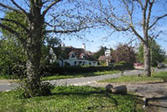
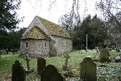
9 Little Wittenham
 Little Wittenham is a very small village with an attractive parish church and several
attractive old houses, many of them listed and the whole village is within a conservation area. Little Wittenham is a very small village with an attractive parish church and several
attractive old houses, many of them listed and the whole village is within a conservation area.
Nearby, and just over a footbridge over the Thames, is
Day's Lock which is well known locally for the Annual
Pooh Sticks World Chamionships. The event is inspired
by A.A. Milne's tale about Winnie the Pooh and raises
funds for charity. It involves dropping a stick into the
river and seeing how long it takes to get to the finish
line. Teams from across the globe take part in the event.
Overlooking
the village are the Wittenham Clumps which stand on top
of the Sinodun Hills. 'Sinodun' is a Celtic name, Seno-Dunum,
meaning 'Old Fort'. In the Iron Age, the hill fort at Castle
Hill dominated the region, providing protection for
the local villagers and their animals. The
only obvious sign of the fort now is the ditch around
the base of the hill.
Both Castle Hill and Round Hill offer superb view over
the Thames and the village of Dorchester on Thames and beyond, and
from Round Hill there is a good view of the village. The
Wittenham Clumps and the nearby Little Wittenham Wood
are part of a nature reserve managed
by the Earth Trust which is part
of an estate of 300 hectares which includes a conservation
farm and a new woodland dedicated to forestry research.
The village of Dorchester on Thames is only a short walk away from Days Lock, and Castle Hill and Round Hill can both be climbed and the nature reserve explored.
Little Wittenham is on the road between Long Wittenham and Brightwell-cum-Sotwell, about three miles north-east of Didcot.
Find Little Wittenham on the Ordnance Survey map |
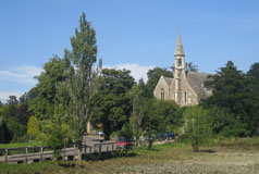
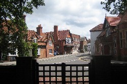
10 Dorchester on Thames
 Dorchester is an attractive and prosperous Thames-side village with a number of fine period buildings
which give the village its special character. Two coaching inns
remain in the village out of the original ten, and antique shops are
very prominent in the High Street. Dorchester is an attractive and prosperous Thames-side village with a number of fine period buildings
which give the village its special character. Two coaching inns
remain in the village out of the original ten, and antique shops are
very prominent in the High Street.
On the edge of Dorchester is the site of an Iron
Age settlement and also the site of the Roman town of Dorcic. Apart from those attractions there is also Dorchester Abbey, which was a former Augustinian abbey. The Abbey is now just the parish church but it does have a tea room and museum for the visitor to see. All in all, Dorchester is well worth a visit!
The village lies within a bend of the River Thames but is actually a short distance from the river. However the river is only a short walk away by footpath, one of which leads to Days Lock and Little Wittenham. The remains of the Iron
Age settlement lie close
to the river at the edge of the village and are evident by
the low hills known as the Dyke Hills.
Dorchester is about
5 miles north-west of Wallingford.
Find Dorchester on the Ordnance Survey map |
11 Shillingford
 Wharf
Road leads down to
Shillingford Wharf, a small Thames-side green which is
the only public access to the river. Here the council
has thoughtfully provided a seat to enable relaxing appreciation
of the river and plaques on the wall record the flood
levels at various times during the 18th & 19th centuries.
They must have been some floods; the flood of January
27th 1809 reached some seven feet above the present ground
level! Wharf
Road leads down to
Shillingford Wharf, a small Thames-side green which is
the only public access to the river. Here the council
has thoughtfully provided a seat to enable relaxing appreciation
of the river and plaques on the wall record the flood
levels at various times during the 18th & 19th centuries.
They must have been some floods; the flood of January
27th 1809 reached some seven feet above the present ground
level!
The river
at Shillingford is bridged by a fine C19 three-arched stone bridge which
was built on the site of an ancient bridge in 1827. And on
the far side of the river is the well-known Shillingford
Bridge Hotel which has a pleasant lawn running down to
the water's edge where mooring is provided for customers. The Kingfisher Inn, another village pub, is on the Henley Road.
The Thames Path leads inland from Shillingford Wharf to Shillingford Bridge, and then on beside the river to Benson. In the other direction the Thames Path follows the A4074 a short distance and then on beside the river to Days Lock and Dorchester on Thames and Little Wittenham.
Shillingford is on the A4074 Reading to Oxford road at the junction with the A329 road to Thame.
Find Shillingford on the Ordnance Survey map |
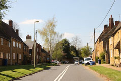
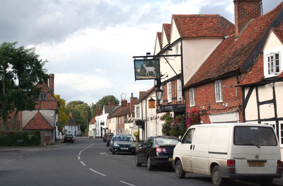
12 Benson
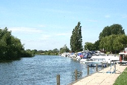 Benson is large village, well served with local amenities and, with
around a dozen shops, the High Street is very busy. On
the edge of the village on the river is Benson Lock and
also a boating marina and popular riverside cafe. Benson is large village, well served with local amenities and, with
around a dozen shops, the High Street is very busy. On
the edge of the village on the river is Benson Lock and
also a boating marina and popular riverside cafe.
There are pubs in the village for refreshment and the Thames path enables a walk either to Shillingford or across the lock to Wallingford.
Benson is about a mile and a half north-east of Wallingford and about half way between Reading and Oxford on the A4074.
Find Benson on the Ordnance Survey map |
13 Crowmarsh Gifford
 Crowmarsh Gifford is on the opposite side of the River Thames to the historic town of Wallingford across Wallingford Bridge. Wallingford is an attractive little market town with several places to eat and drink, and the usual small town shops. Crowmarsh Gifford is on the opposite side of the River Thames to the historic town of Wallingford across Wallingford Bridge. Wallingford is an attractive little market town with several places to eat and drink, and the usual small town shops.
Crowmarsh itself has a couple of pub/restaurants in the centre of the village. In the shadow of Wallingford Bridge there is a riverside car park and a play area complete with a paddling pool. There is also an open-air swimming pool here and a riverside camping/caravan site. Another caravan site is in the centre of the village.
Passing through the arches under the bridge you come to a pleasant riverside open space, ideal for picnics, barbeques, etc, or just for walking with the dog. You have to cross Wallingford Bridge to pick up the Thames Path which takes you northwards to Benson or south to Moulsford, which is about 3 km away.
Find Crowmarsh on the Ordnance Survey map |
14 North Stoke
 North Stoke is a delightful small Thames-side village
lying just off the Goring to Crowmarsh road. The
village itself is on a sleepy backwater, but most people
will perhaps know the village as the home of The Springs
Hotel and Golf Club which is on the "main road". North Stoke is a delightful small Thames-side village
lying just off the Goring to Crowmarsh road. The
village itself is on a sleepy backwater, but most people
will perhaps know the village as the home of The Springs
Hotel and Golf Club which is on the "main road".
The river can be reached by footpath which starts near the medieval parish church, and from here there is a pleasant walk along the river to nearby South Stoke where there is an attractive pub/restaurant.
North Stoke is just off the Goring to Crowmarsh road.
Find North Stoke on the Ordnance Survey map |
15 Moulsford
 Moulsford
is a small Thames-side village on one of the prettiest stretches of the
River Thames opposite the village of South Stoke. Moulsford
is a small Thames-side village on one of the prettiest stretches of the
River Thames opposite the village of South Stoke.
On the bank of the river, on the site of the old ferry
service to South Stoke, is the former waterfront
inn known as the Beetle and Wedge. Now it is more of a
smart restaurant with accommodation.
The Thames Path passes through the village and the river itself can be reached from near the Beetle and Wedge or by a footpath from the main road a quarter of a mile or so north of the village.
Moulsford is on the A329 between Wallingford and Streatley.
Find Moulsford on the Ordnance Survey map
|
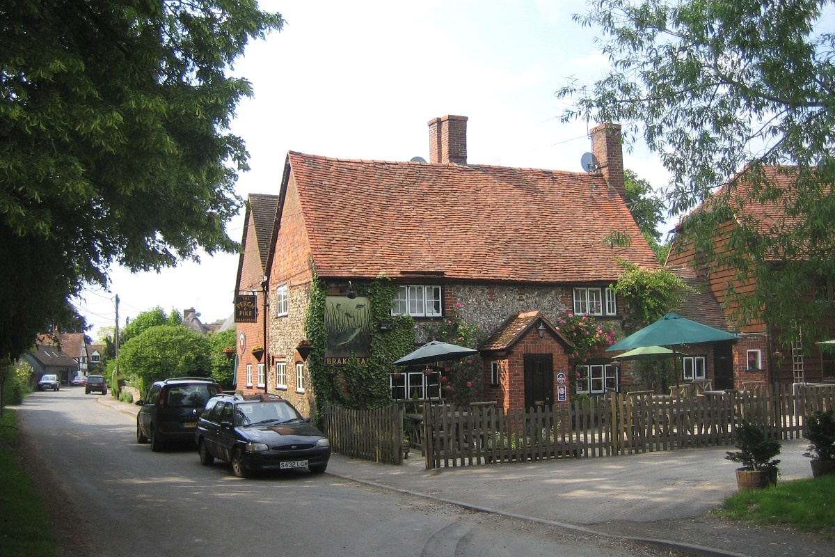
16 South Stoke
 Like some of the other Thames-side villages, you may not realise the river
was there unless you looked at a map or wandered down
the track to the old ferry crossing to Moulsford, from where you can walk northwards along the path to North Stoke. Perhaps though the Perch and Pike pub gives the closeness
of the river away, both by its name and its display of
record catches of fish from the river! Like some of the other Thames-side villages, you may not realise the river
was there unless you looked at a map or wandered down
the track to the old ferry crossing to Moulsford, from where you can walk northwards along the path to North Stoke. Perhaps though the Perch and Pike pub gives the closeness
of the river away, both by its name and its display of
record catches of fish from the river!
A footpath south of the village leads to a pleasant riverside path which takes you to Goring.
Close
to the village is Brunel's Four Arches bridge which takes the railway
across the Thames. This is a listed building.
South Stoke is off the B4009 between Goring and Crowmarsh.
Find South Stoke on the Ordnance Survey map |
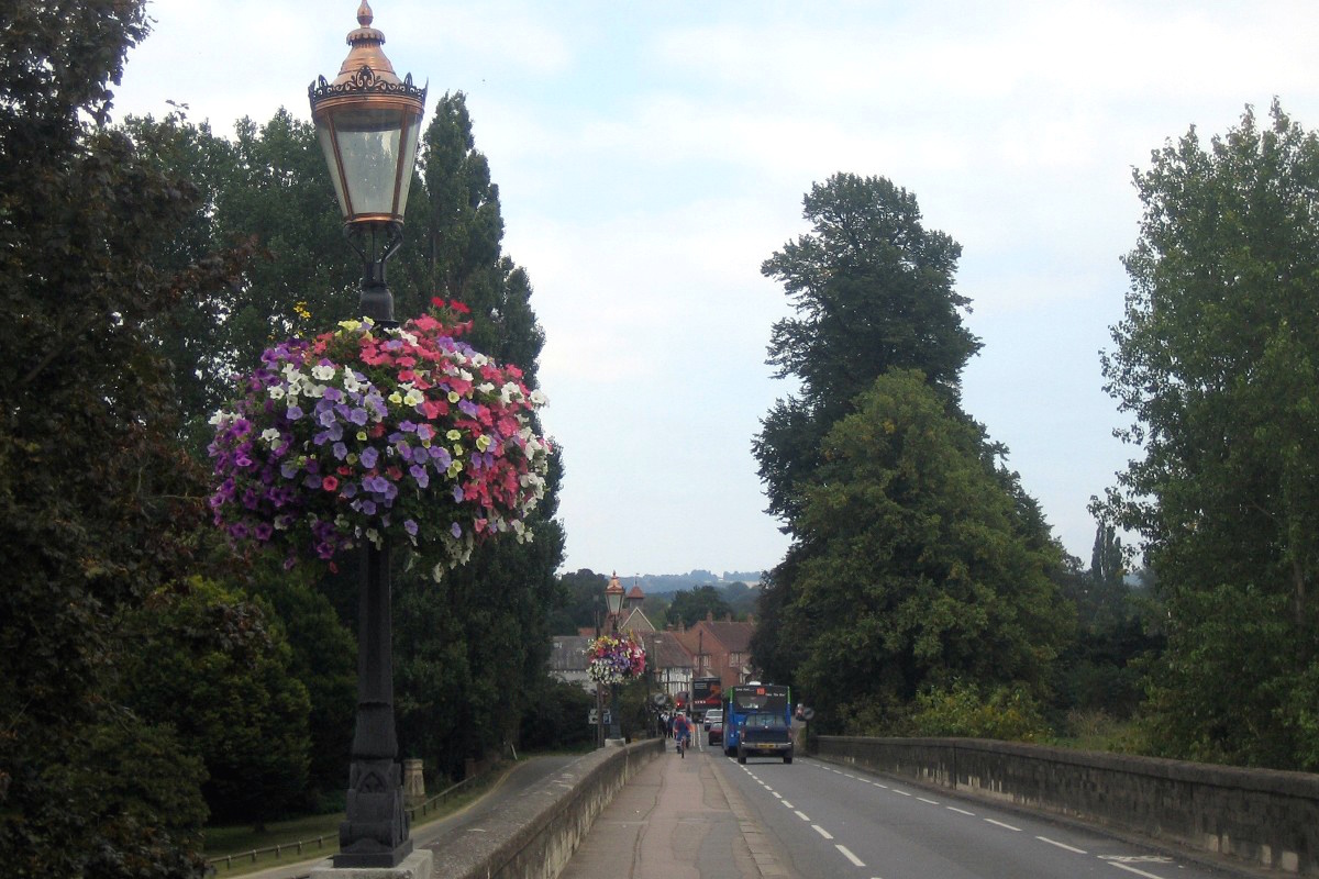
17 Goring
 Most people who have heard of Goring probably associate it with the attractive
gap between the Berkshire Downs and the Chilterns known
as the Goring Gap. Here the villages of Goring and Streatley
stand on opposite sides of the River Thames, Oxfordshire
on one side and West Berkshire on the other, linked by
a fine bridge which was built in 1923. The beautiful riverside
setting and the attractive views of the hills on either
side make Goring an extremely attractive village. In the village there are several pub/restaurants and there is a small cafe in the High Street. Most people who have heard of Goring probably associate it with the attractive
gap between the Berkshire Downs and the Chilterns known
as the Goring Gap. Here the villages of Goring and Streatley
stand on opposite sides of the River Thames, Oxfordshire
on one side and West Berkshire on the other, linked by
a fine bridge which was built in 1923. The beautiful riverside
setting and the attractive views of the hills on either
side make Goring an extremely attractive village. In the village there are several pub/restaurants and there is a small cafe in the High Street.
Next to the bridge is Goring Lock and weir, and from the bridge you can look down and watch the lock in use. By the bridge also is the old mill but this is no longer in use.
It is thought that Goring Lock was build by the local
miller in the C16 to provide a head of water to drive
the water wheel.
The Thames path takes you southwards to Whitchurch on Thames, some 6 km away, and northwards to South Stoke a walk of about 3 km.
Goring is about 5.5 miles south of Wallingford.
Find Goring on the Ordnance Survey map |
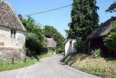
18 Whitchurch-on-Thames
 Whitchurch-on-Thames
is an attractive Thames-side village on the opposite
side of the river to the Berkshire village of Pangbourne, to which it is linked by Whitchurch Bridge. When Whitchurch-on-Thames is approached by road from the north
the road drops down from the Chiltern Hills to the villlage,
and the High Street then follows the hill down to the river. Before long you reach the
toll bridge across the river to Pangbourne. Whitchurch-on-Thames
is an attractive Thames-side village on the opposite
side of the river to the Berkshire village of Pangbourne, to which it is linked by Whitchurch Bridge. When Whitchurch-on-Thames is approached by road from the north
the road drops down from the Chiltern Hills to the villlage,
and the High Street then follows the hill down to the river. Before long you reach the
toll bridge across the river to Pangbourne.
You can walk along the Thames Path across the bridge to Pangbourne and then on to the Berkshire village of Purley on Thames which is on the edge of Reading. Westwards from Whitchurch the Thames Path goes to Whitchurch on Thames, a walk of about 6 km.
Whitchurch has at least two pub/restaurants to chose from if you are in need of refreshment!
Whitchurch-on-Thames
is about half way between Goring and Reading.
Find Whitchurch on the Ordnance Survey map |
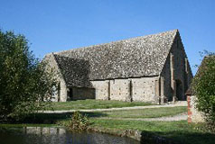
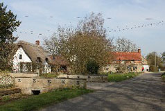
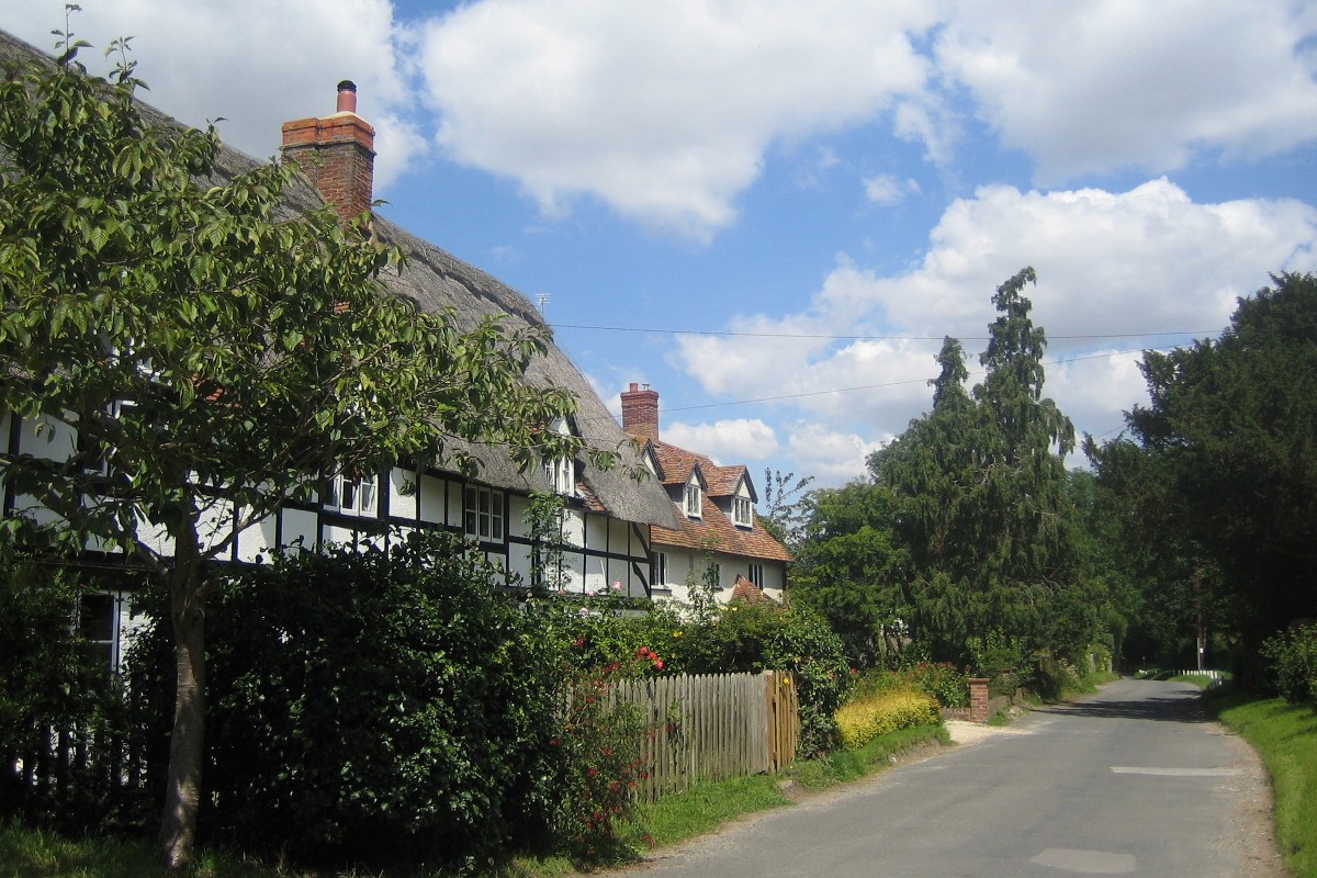
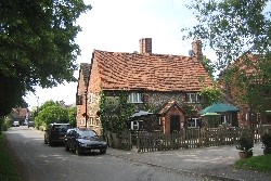
19 Mapledurham
.jpg) Mapledurham is a small estate village and most of the village is a conservation area. Visitors are attracted to the village mainly to see Mapledurham House and Water Mill. Mapledurham House is a Grade I Country House c.1585 which is open weekends and bank holidays during the summer months and of course refreshments are available to visitors to the house. Mapledurham is a small estate village and most of the village is a conservation area. Visitors are attracted to the village mainly to see Mapledurham House and Water Mill. Mapledurham House is a Grade I Country House c.1585 which is open weekends and bank holidays during the summer months and of course refreshments are available to visitors to the house.
The Mill at Mapledurham (in the grounds of Mapledurham house) is a working flour mill and is thought to be the only mill on the Thames still working and producing flour. The core of the present building dates from the 15th century. The Mill continued working until just after the Second World War. In 1980 it was restored and brought back into use.
Unfortunately there are no riverside footpaths from Mapledurham, although it is possible to walk by footpath to Whitchurch on Thames or Caversham.
Mapledurham is on the north side of the Thames a few miles west of Caversham.
Find Mapledurham on the Ordnance Survey map |
20 Shiplake & Lower Shiplake
 Shiplake is on the A4155 road which leads to Caversham and Reading. There is not a lot to see of the village from the main road as both the old village and the newer settlement of Lower Shiplake spread away from the road towards the River Thames, and really, other than the 12th century church and Shiplake Lock, there is little to see of interest in the village. Shiplake is on the A4155 road which leads to Caversham and Reading. There is not a lot to see of the village from the main road as both the old village and the newer settlement of Lower Shiplake spread away from the road towards the River Thames, and really, other than the 12th century church and Shiplake Lock, there is little to see of interest in the village.
The development of Lower Shiplake after the coming of the railway owes much to the River Thames itself. It started with houseboats mooring on the river-bank near the new station and acquiring gardens alongside. Luxurious homes followed and inevitably more and more houses were built within easy reach of the station.
The Thames Path follows the river south to the Berkshire village of Sonning and northwards into Henley on Thames, distances of about 3.5 and 2 km respectively.
Shiplake is south of Henley-on-Thames on the A4155.
Find Shiplake and Lower Shiplake on the Ordnance Survey map |
|